
A Trail Guide for Every Pace
Click the button below to download a version of this guide to print or save to your phone.
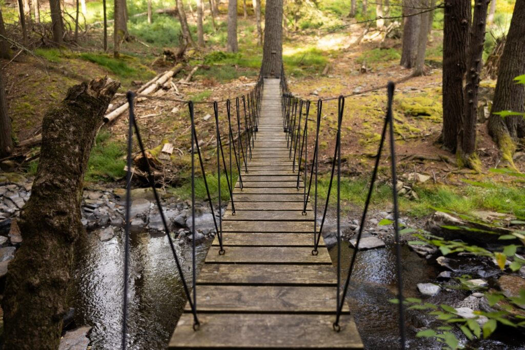
Sullivan County hides its trails the way it hides its best spots: in plain sight, down a gravel road, past the farm stand and around the bend. Wide marshes. Hemlock hollows. Ridgelines that open to the sky. Waterfalls that sound before they come into view. This county rewards the walker who pays attention.
The guide below covers trails for every ability level, from a half-mile waterfall stroll to an all-day summit push on Balsam Lake Mountain. Some begin in the parking lot of a state campground. Others find their trailhead at the end of an unmarked gravel road. All of them offer something real.
Pull on your boots. The river sets the pace from here.
How to Read This Guide
Each trail entry uses the following information to help you choose the right walk for the day.
| EASY | Short distance, minimal elevation gain. Accessible to most hikers including families and beginners. |
| MODERATE | Some elevation gain and/or longer distance. Good fitness helps. Most hikers in reasonable shape handle these well. |
| STRENUOUS | Significant elevation gain, steeper terrain, longer distance. Come prepared and take your time. |
| VERY STRENUOUS | Long distance and/or major elevation gain. Experienced hikers with solid conditioning. Full-day commitment. Start early. |
All trails in this guide are located within Sullivan County, New York. No activity fees or advance reservations are required for any trail listed here.
Note on Dogs: All trails listed here welcome leashed dogs. Please clean up after your pup.
Easy Trails
Big nature in small doses. These walks ask little and give a lot: waterfalls, lake loops, wetland wanders. Bring the kids. Bring the grandparents. Bring whoever needs a breath of clean Catskill air.
Russell Brook Falls
Short, sweet and sonorous. This half-mile walk through hemlock shadow leads straight to the sound of rushing water. Russell Brook tumbles over a mossy ledge into a plunge pool below. Come in spring when snowmelt pushes the falls to full voice.
| Ability Level | Easy |
| Length | 0.3 miles (round trip) |
| Type | Out and Back |
| Est. Time | 30 minutes |
| Elevation Gain | Minimal |
| Highlights | Waterfall with upper and lower viewing angles; peaceful hemlock forest |
| Location | Russell Brook Road off Morton Hill Road, near Livingston Manor |
| Parking | Lower parking area on Russell Brook Road |
| Dogs Allowed | Yes, leashed |
Note: Russell Brook Road is unpaved and not always well maintained. Drive slowly.
Alder Lake Loop
A gentle wander around a gem of a Catskill lake. Stonework ruins of the old Coykendall Mansion greet you at the trailhead. The path curves clockwise around the water, crossing small bridges over inlet streams. Popular for fishing and camping too. Families with young hikers love it here.
| Ability Level | Easy |
| Length | 1.7 miles (round trip) |
| Type | Loop |
| Est. Time | 1 hour |
| Elevation Gain | Minimal |
| Highlights | Historic mansion ruins, quiet lake, beaver activity, bridges over inlet streams |
| Location | Alder Creek Road off Beaverkill Road, Livingston Manor area |
| Parking | Large lot at end of access road (gate may be closed seasonally; parking outside gate possible) |
| Dogs Allowed | Yes, leashed |
Note: The access road is not always well maintained. Check conditions before visiting.
Basha Kill Tower Trail
Flat and wide, this trail rolls through one of the largest freshwater wetlands in the Hudson Valley. The Basha Kill draws serious birders from across the region. Watch great blue herons lift off in slow arcs. Listen for red-winged blackbirds in the reeds. The observation platform near the mile mark rewards with a wide marsh panorama.
| Ability Level | Easy |
| Length | 2.3 miles (round trip) |
| Type | Out and Back |
| Est. Time | 1 to 1.5 hours |
| Elevation Gain | Negligible |
| Highlights | Observation tower with marsh views, exceptional birding, wetland wildlife |
| Location | Haven Road off Route 209, Wurtsboro |
| Parking | Parking area at end of Haven Road (left off Route 209, approx. 1.7 miles south of Exit 113) |
| Dogs Allowed | Yes, leashed |
Note: Trail can be wet and muddy. Wear waterproof footwear after rain.
Walnut Mountain West Lake Loop
A short, satisfying spin on wide carriageways through hardwood forest. Walnut Mountain is a quiet local favorite. The West Lake Loop gives first-timers a low-commitment taste of the trails here with enough nature to feel like a real walk in the woods.
| Ability Level | Easy |
| Length | 1.0 mile (round trip) |
| Type | Loop |
| Est. Time | 30 to 45 minutes |
| Elevation Gain | Minimal |
| Highlights | Shaded hardwood forest, peaceful atmosphere, gentle terrain |
| Location | Main parking area, Walnut Mountain Park |
| Parking | Main lot at trailhead |
| Dogs Allowed | Yes, leashed |
Note: Multiple loops available for those who want to extend their outing.
Moderate Trails
A little more hill, a lot more reward. These trails deliver river overlooks, waterfall loops and fire tower views. You earn the scenery. The scenery earns the walk.
Tusten Mountain Loop
Start at the Delaware River and climb through a landscape shaped by centuries of quarrying. Stone piles, old quarry pits and a river overlook mark the way. The Delaware glints through the trees from the lookout at the high point. History underfoot and big water below. A true Sullivan Catskills walk.
| Ability Level | Moderate |
| Length | 3.1 miles (round trip) |
| Type | Loop |
| Est. Time | 1.5 to 2.5 hours |
| Elevation Gain | Moderate gain with some steeper spots |
| Highlights | Delaware River overlook, historic quarry sites, lean-to and tent camping nearby |
| Location | Crawford Road off Route 97, between Narrowsburg and Barryville |
| Parking | Lot at end of Crawford Road, 0.3 miles from Route 97 |
| Dogs Allowed | Yes, leashed |
Note: Tusten Road is closed to vehicles from December through March.
Red Hill Fire Tower
The climb earns the view. Red Hill rises steeply through mixed forest to a restored fire tower that volunteers staff on summer weekends. Climb the cab for a 360-degree sweep of the Catskill highlands. On a clear day the horizon seems to go on forever. One of five restored Catskill fire towers and well worth the ascent.
| Ability Level | Moderate |
| Length | 2.6 miles (round trip via Dinch Road) |
| Type | Out and Back |
| Est. Time | 2 to 3 hours |
| Elevation Gain | 840 feet gain (20% average grade near summit) |
| Highlights | Restored fire tower with 360-degree views, historic observer’s cabin, volunteer stewards on summer weekends |
| Location | Dinch Road off Red Hill Road, near Grahamsville |
| Parking | Small parking area at end of Dinch Road (unpaved; SUV or high-clearance vehicle recommended) |
| Dogs Allowed | Yes, leashed |
Note: Dinch Road is sometimes gated. If closed, add 0.6 miles each way from roadside parking at Rudolph Road intersection. A second trailhead on Denning Road near Claryville offers a longer but equally scenic approach.
Jensen Ledges
A short but dramatic hike to a series of rocky ledges above the Delaware River’s Big Bend. The views down to the water are the kind that make you stop mid-sentence. A cascading stream crosses the trail just before the ledges. Stone cairns mark the first overlook. Wild and a little wild-feeling. Worth every step.
| Ability Level | Moderate |
| Length | 2.1 miles (round trip) |
| Type | Out and Back |
| Est. Time | 1.5 to 2 hours |
| Elevation Gain | Significant gain over short distance |
| Highlights | Delaware River panorama from stone ledges, cascading stream, historic stone quarry remnants |
| Location | Bouchouxville Road off Lordville Road, north of Long Eddy near Route 97 |
| Parking | Parking area at end of Bouchouxville Road |
| Dogs Allowed | Yes, leashed |
Note: Bouchouxville Road is scenic but rough. All-wheel drive with higher clearance recommended. Timber rattlesnakes are native to this area. Stay on the trail and do not reach into rock crevices.
Neversink: Denton & Mullet Brook Falls Loop
Two waterfalls for the price of one. This loop through the Neversink Unique Area moves through laurel groves and evergreen forest to Denton Falls on the Neversink River, then swings back via Mullet Brook Falls. The river sings the whole way. Muddy in wet weather. Worth it anyway.
| Ability Level | Moderate |
| Length | 4.6 miles (round trip) |
| Type | Loop |
| Est. Time | 2.5 to 3.5 hours |
| Elevation Gain | Moderate with some steeper pitches |
| Highlights | Denton Falls on the Neversink River, Mullet Brook Falls, laurel thickets, bridged stream crossings |
| Location | Katrina Falls Road off Route 17, Exit 109 (east or west) |
| Parking | Small lot at end of Katrina Falls Road (3.5 miles from Exit 109E) |
| Dogs Allowed | Yes, leashed |
Note: Bridges can be slippery from rain and moss. Use caution. River rocks near falls are slippery; current runs fast especially after rain.
Trout Pond Out & Back
Russell Brook Falls greets you at the start. Trout Pond rewards you at the end. In between: a gentle climb through mixed forest past wildflower pockets and stream crossings. Swim (or fish) at the pond. A classic Catskill half-day. Pack a lunch.
| Ability Level | Moderate |
| Length | 3.0 miles (round trip) |
| Type | Out and Back |
| Est. Time | 2 to 2.5 hours |
| Elevation Gain | Gradual with some uphill |
| Highlights | Russell Brook Falls, Trout Pond with sandy beach area, dam overlook |
| Location | Russell Brook Road off Morton Hill Road, near Livingston Manor |
| Parking | Lower parking area on Russell Brook Road |
| Dogs Allowed | Yes, leashed |
Note: Russell Brook Road is unpaved. Drive slowly.
Strenuous Trails
For hikers who know their legs and trust the climb. The summit views on Balsam Lake Mountain are some of the best in the Catskills. Take your time. Bring more water than you think you need.
Balsam Lake Mountain Fire Tower
The westernmost peak in the Catskill Park. The fire tower at the summit delivers a full-compass view with nothing blocking the sky in any direction. The climb is steep and honest. Earn it. The Catskill Peaks stretch east. The Delaware River Valley opens to the west. Balsam Lake Mountain stands alone up here, and the view proves it.
| Ability Level | Strenuous |
| Length | 4.3 miles (round trip) |
| Type | Out and Back / Loop |
| Est. Time | 3 to 4 hours |
| Elevation Gain | 1,208 feet gain (ascent averages over 25% grade on the steepest section) |
| Highlights | Fire tower with unobstructed 360-degree views, westernmost Catskill summit, lean-to near summit, spring on upper trail |
| Location | End of Beaverkill Road via Exit 96 off Route 17, through Lew Beach and Turnwood |
| Parking | Parking area at end of Beaverkill Road |
| Dogs Allowed | Yes, leashed |
Note: A demanding ascent. Take breaks and bring plenty of water. Fire tower cab open weekends in summer.
Very Strenuous Trails
All-day adventures on serious terrain. These trails reward experienced hikers with wild ridgelines, deep gorges and waterfalls that take a whole morning to reach. Plan ahead. Start early. Go slow.
Alder Lake to Millbrook Ridge (Beecher Lake Overlook)
Start at a serene mountain lake and climb to one of the Catskill Highest Hundred. Beaver meadows line the lower trail. The upper ridge breaks through the treeline at 3,450 feet. At the far end of the ridge a lookout reveals Beecher Lake below, home to the Dai Bosatsu Zendo Buddhist monastery. The land here carries a long history of contemplation. Hikers feel it too.
| Ability Level | Very Strenuous |
| Length | 8.6 miles (round trip) |
| Type | Out and Back |
| Est. Time | 5 to 7 hours |
| Elevation Gain | 1,280 feet gain (Millbrook Ridge reaches 3,450 feet, on the Catskill Highest Hundred list) |
| Highlights | Alder Lake, beaver ponds, beaver meadows, Beecher Lake Overlook, Catskill Highest Hundred summit, historic Coykendall Mansion ruins at trailhead |
| Location | Alder Creek Road off Beaverkill Road, via Exit 96 off Route 17 |
| Parking | Large lot at Alder Lake trailhead |
| Dogs Allowed | Yes, leashed |
Note: A full-day commitment. Start early. Bring plenty of food and water. Trail can be wet and muddy. Portions of Millbrook Ridge Trail are steep with loose footing.
Neversink: Three Falls
Three waterfalls. Eight-plus miles. Real Catskill terrain. This is the full Neversink Unique experience. Denton Falls, High Falls and Mullet Brook Falls each have their own character. High Falls demands a steep descent to the river and a steep climb back out. The reward is a roaring curtain of water in a deep gorge. Save this one for a clear day and a willing body.
| Ability Level | Very Strenuous |
| Length | 8.4 miles (round trip) |
| Type | Loop |
| Est. Time | 5 to 7 hours |
| Elevation Gain | Several significant uphills; descent to High Falls drops nearly 500 feet |
| Highlights | Denton Falls, High Falls (dramatic gorge), Mullet Brook Falls, deep forest, bridged stream crossings |
| Location | Katrina Falls Road off Route 17, Exit 109 |
| Parking | Small lot at end of Katrina Falls Road |
| Dogs Allowed | Yes, leashed |
Note: The descent to High Falls is steep with loose rock and pine needles. River rocks are slippery. Current moves fast especially in spring. This is a serious hike. Plan accordingly.
What to Wear & Bring
The Catskills have their own weather. Fog settles in the hollows. Rain comes fast off the ridges. The trails run wet into June. Dress and pack accordingly, and the woods will take good care of you.
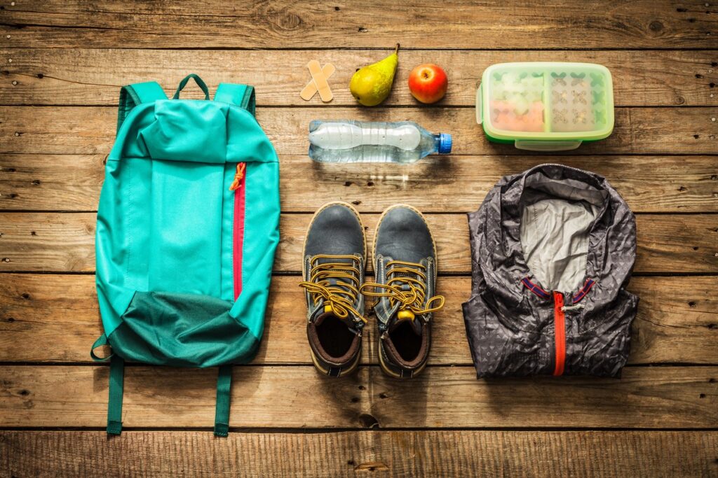
- Trekking Poles: Optional but helpful on steeper trails like Red Hill and Balsam Lake Mountain.
- Footwear: Wear trail runners or hiking boots with ankle support and good traction. Waterproof shoes are worth it in the Catskills, where mud season runs well into spring and wet rocks are the rule near any stream.
- Layers: The Catskills run cool even in summer, especially at elevation. Pack a moisture-wicking base layer, a mid-layer fleece and a lightweight rain shell. Weather moves fast on the ridges.
- Water: Bring more than you think you need: at least 0.5 liters per mile. Hydration packs or insulated bottles both work well. Do not drink from streams without filtration.
- Food & Snacks: Carry energy-dense snacks such as trail mix, nuts or energy bars for any hike over two miles. For longer outings, pack a real lunch.
- Navigation: Download the trail map before you leave. Cell service is unreliable in much of Sullivan County. Carry a paper map or screenshot the route.
- Sun Protection: Sunscreen and a hat matter even on overcast days. Bring sunglasses on open ridge trails and fire tower summits.
- Insect Repellent: Ticks are active spring through fall in the Catskills. Apply repellent before heading out and do a full-body tick check after. Tuck pants into socks on brushy trails.
- First Aid: Carry a basic kit with bandages, blister treatment and any personal medications. Know where you are and who to call. Emergency: 911.
- Headlamp: Always pack one, even for day hikes. Hikes run long. The forest goes dark fast.
Leave No Trace
The land here belongs to everyone who comes after you.
Sullivan County’s trails stay wild because people treat them that way. Follow these seven principles and leave the forest better than you found it.
- Plan Ahead and Prepare: Know the trail, check the weather and pack the right gear. Arrive self-sufficient.
- Stay on the Trail: Walk single-file on established paths. Shortcutting tramples native plants and widens erosion. Muddy trails need rest, not detours.
- Pack It In, Pack It Out: Every wrapper, core and peel comes home with you. Leave the forest cleaner than you found it.
- Leave What You Find: Rocks, wildflowers, feathers and fungi stay where they are. Photographs last longer.
- Minimize Campfire Impact: Use existing fire rings only. Never leave a fire unattended. Cold and dead means cold to the touch.
- Respect Wildlife: Watch from a distance. Do not feed animals. Store food securely. Timber rattlesnakes live on some Sullivan Catskills trails. Give them space and they will give you the same.
- Be Considerate of Others: Yield to uphill hikers. Keep voices low. Let nature be the loudest thing out there.
- Pick Up After Your Dog: Dogs are welcome on every trail in this guide. Bag and pack out waste. Other hikers and the ecosystem will thank you.
The trail ends. The story doesn’t.
You came for the walk and found something harder to name. The fog settling into a hemlock hollow. A heron lifting slow off the marsh. The moment a ridge opens and the whole county spreads out below you with its rivers and farms and ridge after ridge going somewhere you haven’t been yet.
That’s Sullivan Catskills. Stillness & discovery. Mud & wonder. The kind of place that stays with you longer than your boots stay muddy.
There’s more out here waiting in the towns tucked along the rivers, the farms, the studios and the tables where someone made everything you’re about to eat. The trails brought you in. We hope the rest keeps you.