

Scenic Drives, Hikes & Instagram-Worthy Spots in the Sullivan Catskills
Ask anyone who lives here for their favorite view and watch their face light up. Then watch them try to pick just one. A river bend at sunrise? A pond so still it doubles the sky? A ridge where the leaves burn gold in October? We asked around, did some very serious “research,” and put our favorites all in one place.
Whether you’re the type who likes your adventures on four wheels, two boots or one very patient tripod, we’ve got you covered. We rounded up the scenic drives, easy-to-love hikes and photo stops we’d send our own friends to, plus a few tips we usually keep to ourselves. Every single spot is right here in Sullivan County, so you can spend less time driving between places and more time soaking them in.
So, pack the snacks, bring a layer (or two), charge your phone and let’s get going.
Scenic Drives: Winding Roads & Wide-Open Views
Some of our favorite days out here barely involve leaving the car. Windows down, a good playlist (or better yet, no playlist and just the river) and nowhere you need to be until dinner.
The Upper Delaware Scenic Byway (Route 97)

If Sullivan County had a signature road, this would be it. Route 97 hugs the New York bank of the Delaware River, curling past cliffs, farm fields and little river towns that look like they were sketched on a napkin by someone who really loved small towns.
Start in Barryville and roll north through Minisink Ford, Narrowsburg, Cochecton and Callicoon, then keep going toward Long Eddy if the light is good and the snacks are holding up. Along the way, you’ll want to stop at:
The Roebling Bridge, Minisink Ford. Built as an aqueduct for the old Delaware & Hudson Canal, this is the oldest existing wire suspension bridge in the country, designed by John A. Roebling before he went on to the Brooklyn Bridge. It’s history & engineering in one very photogenic package. Park on the New York side and get the long view from the riverbank.
Narrowsburg. The river widens into the Big Eddy here, said to be the deepest point on the entire Delaware. Walk Main Street, grab a coffee, and find a spot along the overlook behind the shops. The water is glassy in the morning and full of sky at sunset.
Callicoon. A classic river town with brick storefronts, a railroad running right alongside the water, and a main street that rewards slow wandering. It’s a perfect turnaround point or a perfect lunch stop. Ideally both.
How to get there: From Route 17, take Exit 104 in Monticello and follow Route 17B west, or pick up Route 55 west from Monticello all the way down to Route 97 in Barryville. Turn right (north) on Route 97 and simply follow the river. In Narrowsburg, Route 52 joins Route 97 through the hamlet, and in Callicoon, Route 17B meets Route 97 if you’d like a quicker way back east.
| Drive Stats | |
|---|---|
| Distance | About 40 miles, Barryville to Long Eddy |
| Drive time | About 1 hour 15 minutes without stops (plan a half day with them) |
| Start / Finish | Barryville / Long Eddy |
| Key stops | Roebling Bridge, Minisink Battleground Park, Tusten Mountain Trail, Narrowsburg, Callicoon |
| Best time | Morning for river fog, late afternoon for golden light |
| Best season | Fall foliage & winter eagle watching |
| Road notes | Two lanes, curvy, narrow shoulders, spotty cell service |
Insider tip: Route 97 is narrow and curvy, and the shoulders are not your friend. Use the marked river access areas and official pullouts for photos instead of stopping on the road. Also, cell service gets moody along the river, so download your map before you leave town.
The Fishing Heritage Loop (Livingston Manor, the Beaverkill & Roscoe)

This one is for anyone who has ever said “wait, pull over” at the sight of a covered bridge. (No judgment. We say it too.)
Start in Livingston Manor, where the Livingston Manor Covered Bridge has spanned the Willowemoc Creek since 1860, set in a little park that practically begs for a picnic. From there, the road climbs north past Waneta Lake (look for the parking area overlooking the water) to the state’s Beaverkill Campground, home of the Beaverkill Covered Bridge. Built in 1865 and lovingly restored, this one-lane beauty is still open to cars and walkers alike, and it looks like something out of a storybook.
Swing back along Craigie Clair Road, cross the old iron bridge over the Beaverkill, and follow the river into Roscoe, aka Trout Town USA. Pause at Junction Pool, where the Beaverkill & Willowemoc meet. This is hallowed ground in American fly fishing, and even if you’ve never held a rod, there’s something mesmerizing about watching anglers cast in the evening light.
On your way back toward Livingston Manor, stop at the Catskill Fly Fishing Center & Museum at 1031 Old Route 17 for a dose of rod-and-reel history right on the banks of the Willowemoc.
How to get there: From Route 17, take Exit 96 for Livingston Manor. In town, head north on County Route 178/179 and turn left on Covered Bridge Road to reach the first bridge. Return to County Route 178/179 north, turn right on County Route 151 past Waneta Lake, then turn left on Campsite Road into the Beaverkill Campground. Continue south onto Craigie Clair Road, turn right across the iron bridge, then left on Beaverkill Valley Road and left on Route 206 into Roscoe. Head east on County Route 178/179 to loop back to Livingston Manor.
| Drive Stats | |
|---|---|
| Distance | About 19 miles round trip |
| Drive time | About 45 minutes without stops (plan 2 to 3 hours with them) |
| Start / Finish | Livingston Manor / Livingston Manor |
| Key stops | Livingston Manor Covered Bridge, Waneta Lake, Beaverkill Covered Bridge, Junction Pool, Catskill Fly Fishing Center & Museum |
| Best time | Early morning when mist rises off the water |
| Best season | Fall foliage, spring hatches |
| Road notes | Quiet county roads; the Beaverkill bridge is one lane with a three-ton limit |
Insider tip: Do this drive in the morning when the mist is still lifting off the water. The creeks steam, the bridges glow, and you’ll have the pullouts mostly to yourself. The museum is open Friday through Monday, 10 a.m. to 4 p.m., so time your loop around a long weekend.
Bethel Backroads & Lake Country

Yes, that Bethel. The hillside where half a million people gathered in 1969 is now home to Bethel Woods Center for the Arts, and the monument at the corner of Hurd Road & West Shore Road overlooks the historic field. It’s peaceful & powerful in equal measure, especially when the late sun pours across the grass. The museum is open daily, 10 AM to 5 PM, through the end of December.
From there, loop past Kauneonga Lake and on to Lake Superior State Park, then wind your way toward Kenoza Lake and Jeffersonville. In Kenoza Lake, stop at the Stone Arch Bridge Historical Park, where a three-arched stone bridge built in 1880 by Swiss immigrants Henry and Philip Hembt spans the East Branch of the Callicoon Creek. Jeffersonville’s main street makes a great last stop for a bite before you head home (or, let’s be honest, before you start planning the next trip).
How to get there: From Route 17, take Exit 104 and follow Route 17B west about 10 miles to Bethel. Bethel Woods sits at 200 Hurd Road. To reach Lake Superior State Park, follow signs to Dr. Duggan Road off Route 17B or Route 55. Continue west to Route 52 for Kenoza Lake, where the Stone Arch Bridge is at 25 Stone Arch Road, near the junction of Routes 52 & 52A. Jeffersonville is just a few miles farther along Route 52.
| Drive Stats | |
|---|---|
| Distance | About 25 miles one way |
| Drive time | About 45 minutes without stops (plan a half day with them) |
| Start / Finish | Bethel Woods / Jeffersonville |
| Key stops | Bethel Woods & the 1969 field, Kauneonga Lake, Lake Superior State Park, Stone Arch Bridge, Jeffersonville |
| Best time | The hour before sunset |
| Best season | Summer through late fall |
| Road notes | Easy, rolling two-lane roads with plenty of places to pull off |
Insider tip: Bring a blanket and time your Bethel visit for the hour before sunset. The light is soft, the crowds are thin, and you’ll get the kind of photo that doesn’t need a filter. Concert days change the parking picture, so check the Bethel Woods calendar before you go.
Hikes: Trail Time & Treetop Views
You don’t need to be a peak-bagger to love hiking here. Most of these hiking trails take an hour or two, many are easy enough for kids and dogs, and the one real climb on our list pays you back with river views. Almost all of them come with a side of birdsong.
Tusten Mountain Trail, near Narrowsburg
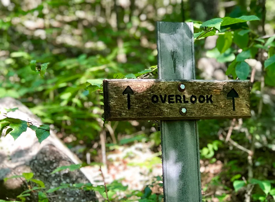
Maintained by the National Park Service, the Tusten Mountain Trail starts at the river’s edge, crosses the Ten Mile River, and climbs to ledges with sweeping views of the Delaware. The bonus round: you’ll cross a historic stone arch bridge on the way, and the forest floor in autumn is a crunchy, golden carpet.
How to get there: From Narrowsburg, drive about 6 miles south on Route 97 and turn onto Crawford Road. The Ten Mile River access is on your right after about 0.4 miles. Park in the gravel lot, then walk north on the gravel road past the access, cross the small stone bridge, and continue for about half a mile. The trail sign and sign-in box are on your right. Don’t drive over the stone bridge to park on Tusten Road.
| Hike Stats | |
|---|---|
| Distance | About 3 miles |
| Difficulty | Moderate to difficult; steep sections, roots, rocks and mud |
| Elevation gain | About 500 feet |
| Trail type | Loop with a linear return to the river access |
| Time needed | 1 to 3 hours |
| Parking | Ten Mile River Access gravel lot (about 15 cars) off Crawford Road |
| Dogs | Welcome on a leash; pack out all waste |
| Hours / Season | Year round, 8:30 AM to 6 PM; Tusten Road isn’t maintained December 1 to April 15 |
| Fees | Free |
Insider tip: Go mid-morning, after the river fog has burned off but before the afternoon light flattens out. Wear real hiking shoes. The climb is short but it means business. There are no restrooms and very little cell service, so plan accordingly.
Frick Pond Loop, Willowemoc Wild Forest
If you want maximum magic for minimum sweat, this is your trail. The Frick Pond Loop winds through hemlock and hardwood forest around a still, mountain-ringed pond that reflects the sky like a mirror on calm days. It’s easy enough for kids and pretty enough for a proposal. Look for Gravestone Junction along the way (yes, there’s a story, and yes, it’s worth asking a local about).
How to get there: From Route 17 westbound, take Exit 96 and turn left onto DeBruce Road. (Eastbound, take Exit 96, turn right at the end of the ramp, left at the stop sign, then left onto DeBruce Road.) Follow DeBruce Road 5.6 miles and turn left onto Mongaup Road. Drive 2.7 miles to where the road splits, stay left on Beech Mountain Road, and the Frick Pond parking area is on your left after 0.3 miles.
| Hike Stats | |
|---|---|
| Distance | About 2.1 miles |
| Difficulty | Easy |
| Elevation gain | Minimal |
| Trail type | Loop |
| Time needed | About 1 hour |
| Parking | DEC Frick Pond parking area on Beech Mountain Road |
| Dogs | Welcome; leash recommended |
| Hours / Season | Year round; bring traction for winter ice |
| Fees | Free |
Insider tip: Feeling ambitious? Hop onto the Flynn Trail from the same lot and keep climbing toward Beech Mountain, which at 3,126 feet is the highest point in Sullivan County. Bragging rights included at no extra charge.
Bashakill Wildlife Management Area, Wurtsboro
Thousands of acres of wetland, woods and open water make the Bashakill a birder’s dream & a photographer’s playground. Flat trails follow the old D&H Canal towpath and a former railroad bed along the marsh, so you can wander for an hour or an afternoon. Herons stalk the shallows, turtles sun on logs, and the reflections at dawn are downright unfair.
How to get there: From Route 17, take Exit 113 and follow Route 209 south toward Port Jervis. Turn left onto Haven Road (look for the Moose Lodge on your left). There’s parking along Haven Road, with towpath access via Towpath Road, plus a lot north of Haven Road where the rail trail begins. Keep going on Haven Road and turn right onto South Road for the boat launches and more water views.
| Hike Stats | |
|---|---|
| Distance | Up to about 5.7 miles of trail; choose your own out and back |
| Difficulty | Easy terrain, with roots, rocks and mud in spots |
| Elevation gain | Flat |
| Trail type | Out and back |
| Time needed | 1 hour to a full morning |
| Parking | Haven Road and South Road lots off Route 209 |
| Dogs | Check posted DEC rules at the trailheads |
| Hours / Season | Year round; best at sunrise |
| Fees | Free |
Insider tip: Sunrise is the move here. Bring binoculars, a paddle if you’ve got one, and bug spray in the warmer months. The section of rail trail north of Haven Road is the driest and easiest going, while the stretch to the south often floods after rain.
Minisink Battleground Park, Minisink Ford
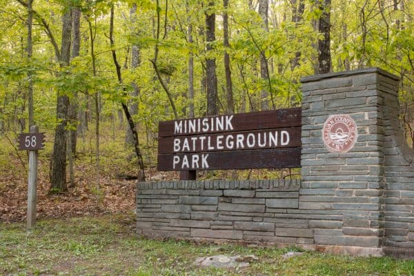
History & hemlocks share the trail here. This county park marks the site of a 1779 Revolutionary War battle, and its shady trails (the Battleground, Woodland and Old Quarry trails) wind past interpretive signs, rock outcrops and quiet woods. It’s a great leg-stretcher between stops on Route 97, and it pairs perfectly with a visit to the nearby Roebling Bridge.
How to get there: Take Route 97 to Minisink Ford, then turn onto County Route 168. The park is about a mile up the road at 58 County Road 168, Barryville. The parking lot is just past the entrance, and the Battleground Trail starts at the visitor interpretive center.
| Hike Stats | |
|---|---|
| Distance | Several short loops; trail brochures at the interpretive center |
| Difficulty | Easy, with rocky footing in spots |
| Elevation gain | Gentle; one short climb to the battleground |
| Trail type | Loops |
| Time needed | About 1 hour |
| Parking | On-site lot with restrooms and picnic areas |
| Dogs | Call Sullivan County Parks at (845) 807-0287 |
| Hours / Season | Mother’s Day weekend through Columbus Day |
| Fees | Free |
Insider tip: It’s an easy walk, but the terrain is rocky in spots. Leave the flip-flops in the car. The park’s season wraps up on Columbus Day, so pencil it in for next spring if you’re visiting late in the fall.
Lake Superior State Park, Bethel
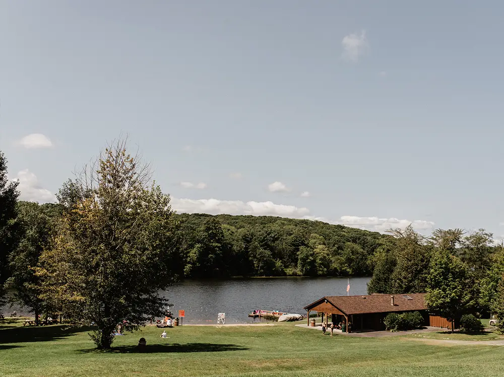
Sometimes you just want a gentle lakeside wander with no summit required. This 1,409-acre county-run park is all water & woods, with picnic spots, Chestnut Ridge Pond, and summer swimming. There are no marked trails, which means you get to make your own easy ramble along the shore. Come fall, it’s wonderfully quiet, with maples blazing along the water.
How to get there: From Route 17, take Exit 104 and head west about 10 miles. The park is off Dr. Duggan Road in Bethel, reachable from either Route 17B or Route 55.
| Hike Stats | |
|---|---|
| Distance | Your call; no marked trails |
| Difficulty | Easy |
| Elevation gain | Minimal |
| Trail type | Informal shoreline walks |
| Time needed | 30 minutes to a lazy afternoon |
| Parking | On-site lots off Dr. Duggan Road |
| Dogs | Check posted park rules |
| Hours / Season | Year round; beach swimming Memorial Day through Labor Day |
| Fees | Free off-season; $5 per person beach day pass in summer |
Instagram-Worthy Spots: Golden Light & Good Angles
You already know some of these from the drives and hikes above, but here’s your cheat sheet for the shots that make people ask, “wait, where IS that?”
- The Roebling Bridge at golden hour. Shoot from the riverbank so the bridge’s long, low profile stretches across the frame. In the morning, fog on the water turns it dreamy. Find this IG-worth spot on Route 97 at Minisink Ford.
- Covered bridge reflections. On a windless morning, the creek under the Livingston Manor Covered Bridge acts like a mirror. Get low near the bank (carefully) for the double-bridge effect. Find it on Covered Bridge Road in Livingston Manor.
- Junction Pool silhouettes. Anglers casting into the sunset where two legendary rivers meet. It’s poetry with waders on. Find it in Roscoe, where the Willowemoc & Beaverkill join.
- Frick Pond on a still day. Peak fall color plus a glassy pond equals a photo you’ll be posting for years. Overcast days work too; the colors get deep & moody. Find it on Beech Mountain Road outside Livingston Manor.
- The Bethel field at sunset. Wide open sky, rolling hills, and a whole lot of history in one frame. Find it at Hurd Road & West Shore Road in Bethel.
- Stone Arch Bridge, Kenoza Lake. Stone & water, moss & light. Bring a wide lens and shoot from the park. Find it at 25 Stone Arch Road, Kenoza Lake.
- Narrowsburg’s Big Eddy. Head behind Main Street for the river view, especially at dawn when the water is flat and the hills are just waking up. Find it in Narrowsburg, right off Route 97.
- Bald eagles at Mongaup Falls. Every winter, bald eagles gather at the Mongaup Falls Reservoir in Forestburgh, and the DEC’s Dr. Ted Kerpez Memorial Eagle Viewing Blind puts you right in the action. Viewing peaks in January and February, with early morning and sunset being your best windows. From Monticello, take Route 42 south about 9 miles, turn right onto County Route 43 (Forestburgh Road), and pass the Forestburgh Playhouse. The blind is on the left just before the reservoir bridge, with a small gravel lot for about 10 cars.
Locals’ tip for the eagles: Use the blind or stay in your car, keep your voice down, and skip the drone. The birds are here to rest and feed, and a happy eagle is a photogenic eagle. On January and February weekends, volunteer docents from the Delaware Highlands Conservancy are often on hand with tips.
Local Know-How: A Few Things We’d Tell a Friend
- Download before you go. Cell service in the river valleys and deep forest ranges from “one bar” to “what’s a bar?” Save offline maps and trail info before you hit the road.
- Weekdays & early mornings are gold. Popular spots get busier on fall weekends. Go early and you’ll often have the view all to yourself.
- Dress for the real Catskills. Mornings can be chilly even when afternoons are warm, and trails stay muddy after rain. Layers, waterproof boots, and a dry pair of socks in the car will make you very happy.
- Wear bright colors in the fall. Hunting is permitted on many state lands, including wildlife management areas, during the fall seasons. A blaze orange hat or vest is a smart, easy habit.
- Check yourself for ticks. After any walk through tall grass or brush, do a quick check. It’s a small step that saves a big headache.
- Leave it better than you found it. Pack out what you pack in, stay on marked trails, and respect private property along back roads and riverbanks. The places that make this county special stay special because people care for them.
- Fuel up locally. Our river towns and hamlets are full of cafés, bakeries, general stores and taverns run by people who live here. Ask them for their favorite view. You’ll get a great one, and probably a story, too.
What More Awaits?

That’s the beauty of the Sullivan Catskills: there’s always another bend in the road, another trail through the trees, another pond that catches the light just right. Stillness & spark, river rhythms & small-town warmth, muddy boots & a warm mug at the end of it all.
When you find your own “& moment” out here, share it with us using #SullivanCatskillsNY. We love seeing the county through your eyes.
The roads are open, the trails are waiting, and the view is even better in person. Come see us.